
Mike Hyslop is the recipient of Michigan Tech’s 2021 Distinguished Teaching Award
in the Assistant Professor/Lecturer/Professor of Practice category.
Mike Hyslop is a principal lecturer in the College of Forest Resources and Environmental Science at Michigan Technological University. He received his undergraduate and master’s degrees in geography from Michigan State
University and is earning his Ph.D. in forest science from Michigan Tech. Prior to
joining MTU 26 years ago, Hyslop worked as a program specialist for the Great Lakes
Commission.
“Mike is an outstanding teacher who is very effective at relating to students as they
develop their skills in geospatial sciences. His classes have significant lab and
field components, and these merge new technologies with understanding landscapes and
geomorphology. Mike cares about student learning, and has received our College distinguished
faculty member award from students on a number of occasions. Once students have taken
a class with Mike, he continues to mentor them as they utilize technological tools
developed in his classes and apply them in their later studies. This mentorship often
also extends into the workplace as our graduates embark on their careers.”
Melissa Baird is the recipient of Michigan Technological University’s 2021 Distinguished
Teaching Award in the Associate Professor/Professor category.
Q: What do you do in your work?
MH: I’m a principal lecturer, which means my position is 100% teaching. That said,
I wear several hats. I direct our master’s in GIS degree program, which has both accelerated and non-accelerated options. I coordinate
our summer and fall camps and I teach classes at both.
I teach geographic information science (GIS) courses to both graduate and undergraduate
students in the College of Forest Resources and Environmental Science (CFRES). GIS
melds maps and databases together, which allows the user to perform analysis and to
make custom maps.
Our curriculum in CFRES is largely field based, so I teach courses that have a significant
outdoor component. These include the practical use of GPS technology, which helps
students ensure they’re in the right place and to record where they were working.
I also teach a plant-landform-ecosystem interactions course, which weaves together
ecology, geomorphology and soils to better understand why vegetation grows where it
does. GIS is central to all my courses, whether to organize field data, to search
information from online spatial data or to create a map of a study.
Distinguished Teaching Award
Since 1982, the annual Michigan Tech Distinguished Teaching Award has been awarded in two categories: Associate Professor/ Professor and Lecturer/Professor
of Practice/Assistant Professor. The award nomination and review processes are student-driven;
finalists are selected based on student ratings regarding quality of instruction.
Winners receive $2,500 and a plaque at an awards dinner sponsored by the Office of
the President in the fall.
At the graduate level, I offer classes in GPS and GIS project management. In those
courses, students learn to use more advanced data collection tools and how to organize
and better manage large data sets.
Q: Why do you care?
MH: For our majors, the things I teach are integral for what they will be doing in
their jobs, especially if they end up working outside for their careers. The physical
attributes of the landscape — covered in my geomorphology class — are fundamental
to ecology. And location is important to pretty much everything humans do. GPS and
GIS help us collect, organize and store many different types of information. These
skills and tools can help us work more effectively and efficiently, which is critical
in a time of increasing population, conflict and an uncertain climate future. Furthermore,
GIS can be used in many other disciplines outside of natural resources, including
epidemiology, engineering, marketing and logistics (to name a few).
But beyond essentials, I want the students to learn the material well and to be interested
in it.
Q: Why do others care? Who benefits from your work?
MH: A lot of what I teach is being prepared before you go out in the field. You don’t
want to stumble into the middle of nowhere before you look at maps and plan your day.
You have to have a blueprint for what you’re going to accomplish. With photos and
GIS layers, you can plan the majority of what you’re going to encounter and be well
prepared for if things go wrong. Maps are simplifications of the real world, but are
great tools for organizing, navigation and communication.
Because of the expertise they gain, my students can make maps and collect robust data.
GIS is a desirable skill, so a number of them have been employed even while they are
still in school. And many of them end up using GIS in their summer or permanent jobs.
Q: Are there specific teaching methods/styles/philosophies that make you successful?
MH: I never had any formal training in teaching. Part of my success is that you can
learn from bad teachers what not to do. Everyone has had a class they would not care
to repeat. I try to not be that guy.
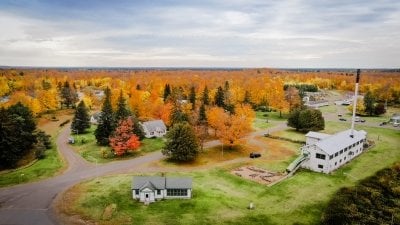
and lodging in historic Alberta Village, built by Henry Ford and operated as a field
station supporting research and natural resource education since 1954.
I feel I benefit from the material I teach — GIS and GPS are very visual and hands-on.
Because I have spent significant time both collecting data and organizing and mapping
it, I can weave a lot of real-world experience into what I demonstrate. Students seem
to appreciate that. I also tell a lot of dad jokes and puns. (“This is a gneiss rock
— don’t take it for granite.”)
With large classes in the field, I send smaller groups in different directions, then
pop in on them when they’re in the woods, ask how things are going and discuss what
they’re doing. Being able to answer questions during a hands-on lab is invaluable.
Early in a semester, I try to provide detailed instructions so students can successfully
complete an assignment without asking a lot of questions. As time progresses, I give
less instruction because I expect them to integrate what they learned earlier to perform
more complex tasks. This helps to reinforce necessary skills.
A lot of students comment after the fact that they really understand GIS more after
learning to integrate their own field data. The act of collecting your own data and
combining it with other information makes it concrete for students, and they see the
value in what they’ve learned.
It’s always nice to hear from students who have been gone for a while who say, “Thank
you, I feel like you gave me a solid grounding and that’s why I’m doing what I’m doing
now.” My take on this is, “I have a job I like because of your class.”
Q: What do you think makes for a successful learning experience?
MH: Students appreciate clear expectations and that what is required is spelled out
for all assignments. My lectures provide both background (theory) and application
with specific examples. And lots of bad jokes.
I try to get to know everyone in my classes, which can be challenging with large class
sizes. At a minimum, I learn everyone’s name. I listen and react to feedback, and
ask for student opinions when appropriate. Mutual respect can go a long way.
Q: Who (or what) inspired you to become a teacher?
MH: Circumstance inspired me to become a teacher — or the inability to say no, perhaps.
I came to Tech as a GIS analyst funded by the Groundwater Education in Michigan Center.
I initially worked with local health departments to help collect GIS data and worked
on other groundwater protection issues. After being at Tech for only a few months,
I was asked to teach some classes while a faculty member was on sabbatical. I got
involved in a number of research projects, and began teaching regular short courses
in GIS. I was eventually asked to teach the GPS class at fall camp. I said yes because
I didn’t think I could say no, so I suppose I eased into it.
Both my parents were teachers, but I never thought I wanted to teach. I am glad I
was wrong, because I really enjoy working with students.
Q: What opportunities does this award open up for you?
MH: It’s nice to be recognized. It’s my understanding that this award comes from students,
so thank you to them!
Q: What are the challenges you face?
MH: Teaching through COVID over the past few years has been challenging. In 2020,
I found myself regularly on Zoom until 9 or 10 p.m. at night, trying to help students
through their labs, which are normally offered face-to-face with a teaching assistant.
I have since tried to back off from being available that much!
I teach technology-based courses, so it’s a constant need to update my materials as
software changes annually. I have to completely go through all of my material every
time I teach a class to ensure it’s still current. I’m not alone in that, though,
and it comes with the territory.
Michigan Technological University is a public research university founded in 1885 in Houghton, Michigan, and is home to more than 7,000 students from 55 countries around the world. Consistently ranked among the best universities in the country for return on investment, the University offers more than 125 undergraduate and graduate degree programs in science and technology, engineering, computing, forestry, business and economics, health professions, humanities, mathematics, social sciences, and the arts. The rural campus is situated just miles from Lake Superior in Michigan’s Upper Peninsula, offering year-round opportunities for outdoor adventure.